SmartConstruction Implementation Provides Cutting Edge Benefits
Technology continues to evolve at a rapid pace in the construction industry, and those companies that embrace and fully utilize it are more likely to win future bids and finish jobs faster and more profitably. Komatsu is committed to helping customers optimize their jobsite productivity through its SMARTCONSTRUCTION suite of offerings, including intelligent Machine Control dozers and excavators.
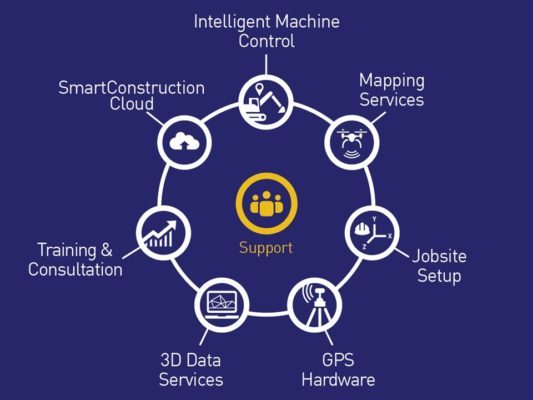
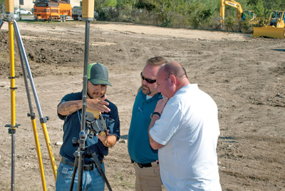
Available through Komatsu distributors, SMARTCONSTRUCTION provides aerial mapping, 3-D modeling, training and consultation, GPS hardware and jobsite setup. Komatsu-certified Technology Solutions Experts (TSEs) and SMARTCONSTRUCTION consultants can assist customers with technology implementation as well as optimization of the jobsite.
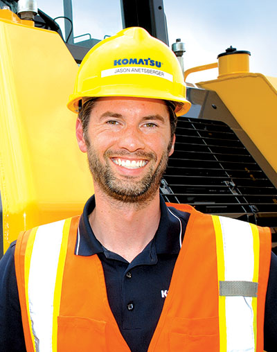
“We want every user to realize the full potential of their jobsite,” stated Jason Anetsberger, Komatsu Senior Product Manager. “Technology is changing every day, and our customers want to be on the cutting edge. With SMARTCONSTRUCTION, we can help them access the latest innovations. Our TSEs and consultants have the knowledge and skills to help with every aspect, whether it’s choosing the right intelligent machinery and implementing it into a fleet, training on base and rover usage or providing aerial mapping and other solutions that maximize production and efficiency.”
Komatsu sparked a revolutionary leap in machinery with the introduction of its GPS-integrated intelligent Machine Control dozers in 2013. Excavators followed soon after. Komatsu developed SMARTCONSTRUCTION as a one-stop source for solutions that help intelligent Machine Control users maximize production and efficiency.
“For those new to intelligent Machine Control equipment, we offer initial instruction from our certified trainers on how to quickly and easily adopt the technology,” said Anetsberger. “From there, we focus on consulting with customers to deliver the targeted jobsite efficiency improvements.”
SmartConstruction Leads To Improved Accuracy With Aerial Mapping
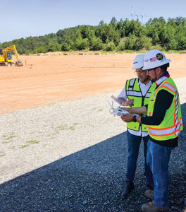
One popular SMARTCONSTRUCTION service is aerial mapping, which gathers topographic data from above. Surveys can be completed before, during and after a project to measure existing and ongoing volumetric changes, stockpile calculations, record amounts of material moved and gather final as-built data.
Anetsberger said customers are amazed by the resolution and accuracy of the data collected. The highly detailed information gathered prior to the start of a project helps in preparing better estimates and bids, as well as in jobsite planning for greater production and efficiency.
During the construction phase, drones can finish numerous surveys per day without disrupting an active jobsite. That allows companies to get a more accurate picture of progress in less time compared to traditional methods.
“Aerial mapping with drones is something that customers request frequently,” said Anetsberger. “Time savings is one of the main reasons. We find that it takes one drone operator roughly 30 minutes to survey a 40-acre site. Compare that to the half-day it typically takes a manned topography crew, and it’s easy to see why there’s a demand for this service. Additionally, on many jobsites, manned topography may measure only every 20 or 50 feet on a grid, whereas a drone can map nearly every tenth of a foot. That offers greater resolution and improved accuracy.”
SmartConstruction Allows Excavation Companies To Concentrate on Moving Dirt
SMARTCONSTRUCTION personnel can not only help companies utilize the data collected from aerial mapping, but also with other data services such as takeoffs.
3-D data modeling services are offered to provide customers of all sizes and capabilities with information for their GPS equipment.
“We are providing quality 3-D data, and our TSEs and consultants know how to optimize it for the machine and the application,” said Anetsberger. “With SMARTCONSTRUCTION, we are able to take all of the knowledge and data we have compiled and use it as a total solution to help our customers operate their jobsites at maximum efficiency. That lets earthmoving and excavation companies concentrate on what they do best – move dirt.”


